


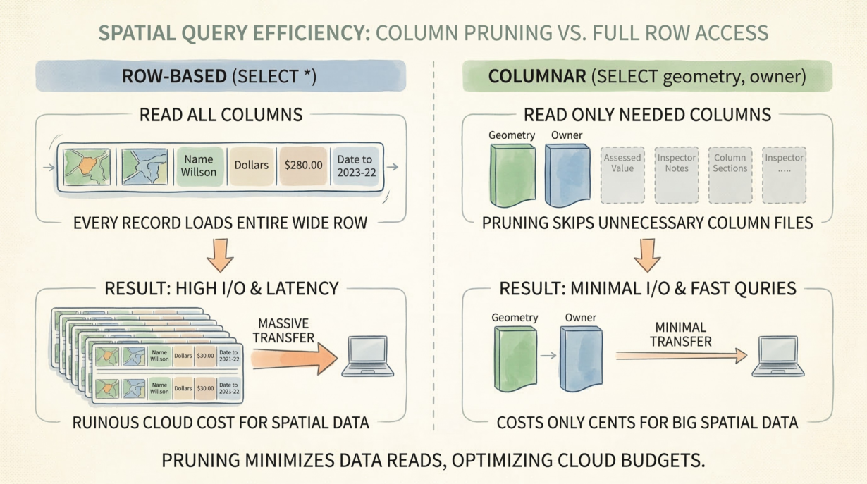
#74: Executing SELECT * on a Wide Spatial Table Bankrupts Your Cloud Budget
Column pruning is the difference between a query that costs cents and one that costs hundreds of dollars. In columnar storage, skipping unnecessary columns means not reading them from disk. In…
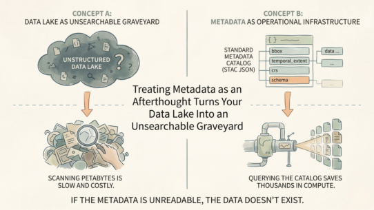
#73: Treating Metadata as an Afterthought Turns Your Data Lake Into an Unsearchable Graveyard
Metadata is not documentation. It’s operational infrastructure. A dataset without machine-readable…
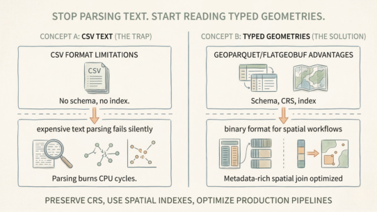
#72: Stop Parsing Text. Start Reading Typed Geometries.
CSV files are a trap for spatial workflows. No CRS. No schema enforcement. No spatial indexes. Every read forces…
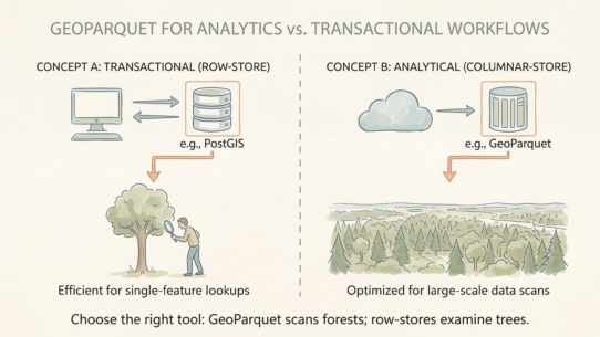
#71: Treating GeoParquet as a Universal Database Replacement Cripples Transactional Workflows
GeoParquet is brilliant for analytics. It’s terrible for real-time applications. Using it for…
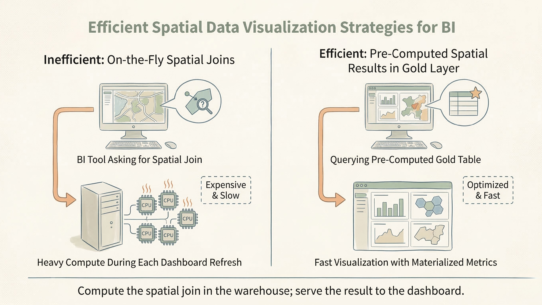
#70: Forcing BI to Execute Spatial Joins Is a Failure of Your Gold Layer
Silver is clean. Gold is fast. If your dashboard is running point-in-polygon queries on the fly, your Gold layer…
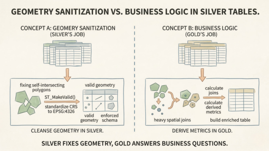
#69: Baking Business Logic Into Silver Tables Guarantees an Inflexible Data Lake
Silver tables exist for one purpose: structural integrity. If you’re calculating business metrics or…
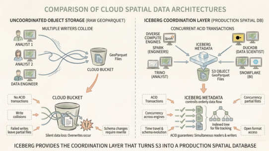
#68: Moving Spatial Files to Cloud Storage Doesn’t Make Them Modern
Adding a transactional metadata layer does. Object storage is cheap but dumb. Multiple writers collide. Silent…
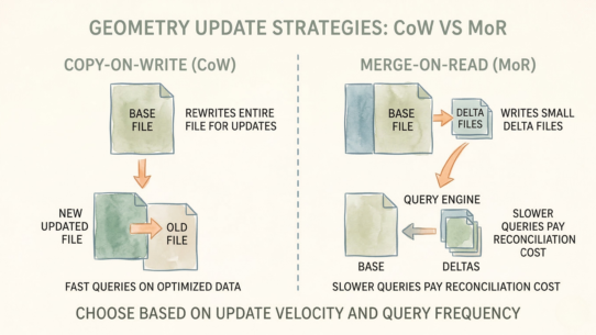
#67: Updating a Single Geometry Shouldn’t Require Rewriting a 500MB File
Unless your read performance depends on it. This is the core trade-off between Copy-on-Write and…
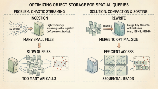
#66: The Fastest Query Engine Can’t Save You From Ten Thousand 10KB Files
Object storage charges by request, not by GB. Opening a 10KB file costs the same as opening a 100MB file—100ms…
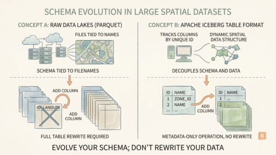
#65: Forcing a Terabyte Rewrite to Add a Column Is an Architectural Failure
Most data lakes require full table rewrites for schema changes. Add a risk score to a billion-row spatial…
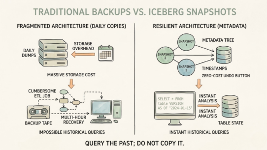
#64: Backing Up Daily Copies of Spatial Data Is a Symptom of a Fragile Architecture
Most organizations manage spatial data history by dumping daily Shapefiles to archive storage. Massive overhead.…


