


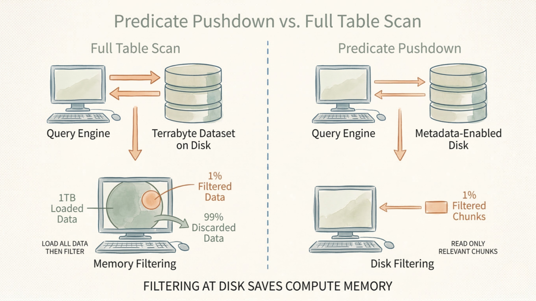
#75: Loading a Terabyte Into Memory Just to Filter 99% of It Is an Architectural Failure
Predicate pushdown is the difference between a sub-second query and an…
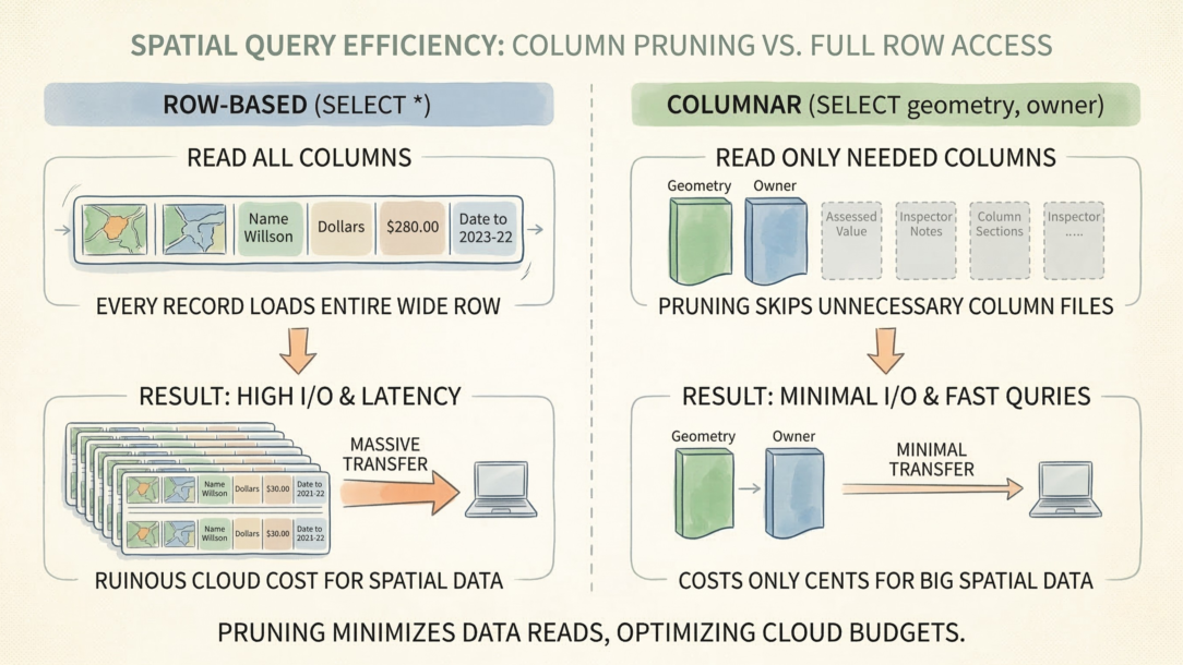
#74: Executing SELECT * on a Wide Spatial Table Bankrupts Your Cloud Budget
Column pruning is the difference between a query that costs cents and one…
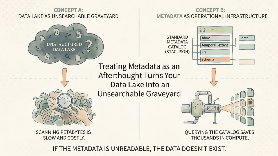
#73: Treating Metadata as an Afterthought Turns Your Data Lake Into an Unsearchable Graveyard
Metadata is not documentation. It’s operational infrastructure. A…
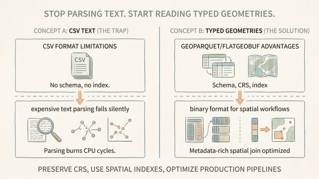
#72: Stop Parsing Text. Start Reading Typed Geometries.
CSV files are a trap for spatial workflows. No CRS. No schema enforcement.…
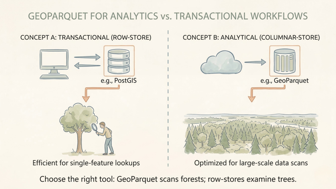
#71: Treating GeoParquet as a Universal Database Replacement Cripples Transactional Workflows
GeoParquet is brilliant for analytics. It’s terrible for real-time…
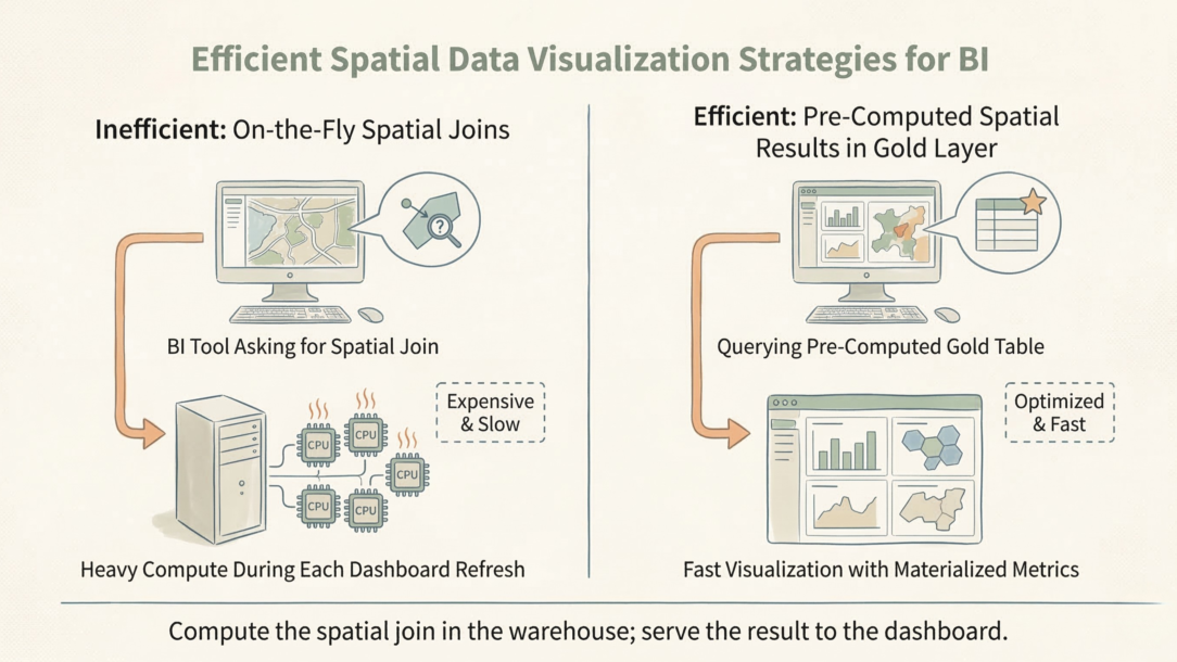
#70: Forcing BI to Execute Spatial Joins Is a Failure of Your Gold Layer
Silver is clean. Gold is fast. If your dashboard is running point-in-polygon…
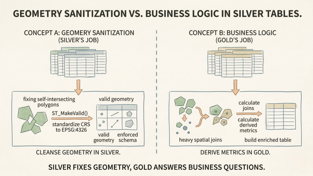
#69: Baking Business Logic Into Silver Tables Guarantees an Inflexible Data Lake
Silver tables exist for one purpose: structural integrity. If you’re…
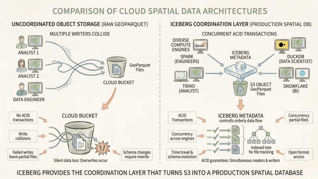
#68: Moving Spatial Files to Cloud Storage Doesn’t Make Them Modern
Adding a transactional metadata layer does. Object storage is cheap but…
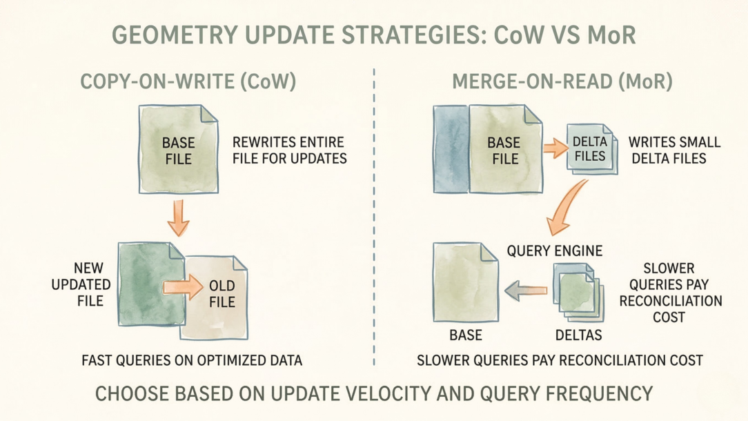
#67: Updating a Single Geometry Shouldn’t Require Rewriting a 500MB File
Unless your read performance depends on it. This is the core trade-off…
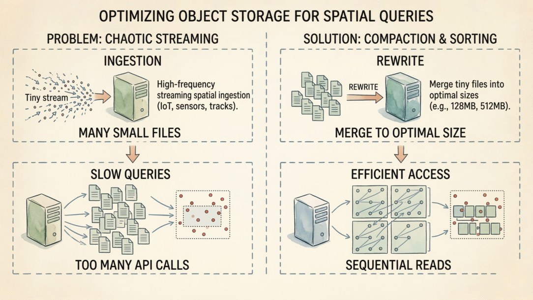
#66: The Fastest Query Engine Can’t Save You From Ten Thousand 10KB Files
Object storage charges by request, not by GB. Opening a 10KB file costs the…


