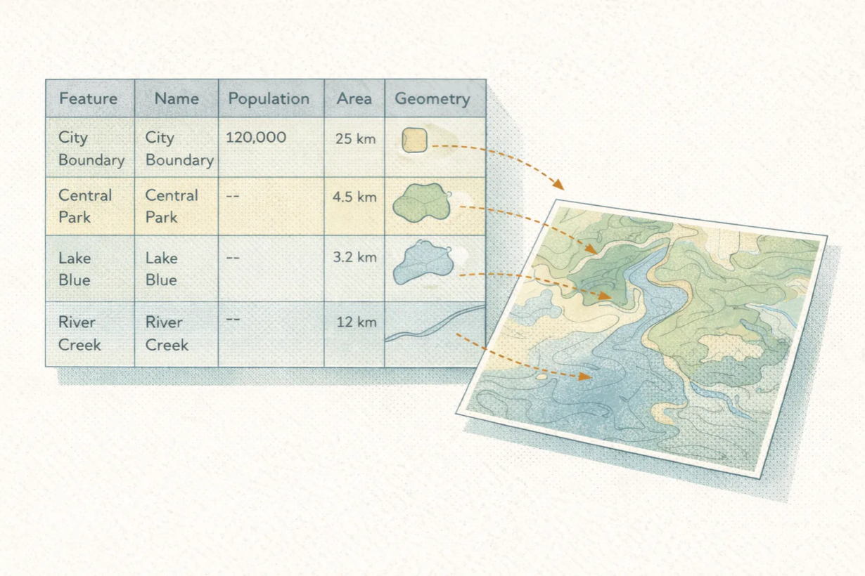
A GeoDataFrame is simpler than it sounds: it’s a table where one column contains geometry.
That’s it. A GeoDataFrame has rows (features), columns (attributes), and one special column holding the spatial part: points, lines, polygons. Every other operation treats it like a regular table.
Filter by attribute? Normal SQL or pandas logic.
Join two tables? Standard join syntax.
Calculate a new column? Regular arithmetic.
The difference is that because one column is geometry, you can run spatial operations on it. Buffer that column. Check if features overlap. Calculate distance. Dissolve by attributes. All in the same structure, without switching between a “spatial tool” and a “data tool.”
This is why GeoDataFrames matter in modern GIS. Traditional tools treat layers as special objects. ArcGIS feature classes handle spatial logic behind the scenes. GeoDataFrames expose it. They’re just tables.
That makes them compatible with the entire Python data ecosystem: Pandas, dask, Spark/Sedona, SQL engines, machine learning. You filter, join, aggregate, and model spatial data using patterns data engineers use for anything else.
It bridges GIS and data engineering. A GIS analyst thinks “layer.” A data engineer thinks “rows and columns.” A GeoDataFrame is both.
The takeaway: If you’re still working with shapefiles or feature classes as isolated objects, switch to GeoDataFrames. Load them from GeoParquet, filter, join, analyze, save results. Think rows and columns, not layers. This pattern scales better, integrates cleaner, and gets you out of the GIS-only workflow into something reproducible and auditable.
Whenever you’re ready, here are 4 ways I can help you grow in GIS & spatial data:
Spatial Lab – My private community where GIS professionals, data engineers, and analysts connect, swap workflows, and build repeatable systems together.
Modern GIS Accelerator – A guided program to help you break out of legacy GIS habits and learn modern, scalable workflows.
Career Compass – A career-focused program designed to help GIS pros navigate the job market, sharpen their pitch, and find roles beyond traditional GIS paths.
Sponsorship: Interested in sponsoring this newsletter (or other content)? Learn more here and fill out the form to get in touch!