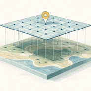
You’re storing data in EPSG:4326, running a distance calculation, and getting nonsensical results. The problem isn’t your code. It’s that you’re measuring degrees, not meters.
EPSG:4326 (WGS84) is a geographic coordinate system. It stores coordinates as latitude and longitude, angular measurements. One degree of latitude is always about 111 kilometers. One degree of longitude changes depending on where you are. At the equator, it’s 111km. At Seattle, it’s 74km. At the poles, it’s zero.
When you calculate distance using lat/lon coordinates directly, you’re computing angular displacement, not actual distance. A buffer of “0.1 degrees” expands differently in the north-south direction than the east-west direction.
Your 1km radius around a point is actually an oval. Any area calculation is completely wrong.
This is why EPSG:4326 is fine for storage and web interchange, but terrible for analysis. GeoJSON uses EPSG:4326. So do most tile servers. It’s a standard. But the moment you need to measure anything (distance, area, nearest neighbor, density) you must reproject to a projected CRS. That converts angular coordinates to linear units (meters, feet) in a specific area.
The fix is simple: Before any measurement operation, reproject to a projected CRS suited for your region. UTM zones work everywhere. State Plane works for US data. Use the projected version. Calculate. Done. Apache Sedona even has a function specifically for this (ST_BestSRID)
Never buffer, measure distance, or compute area in EPSG:4326. Define the CRS if it’s missing, then reproject. That’s the sanity check.
Whenever you’re ready, here are 4 ways I can help you grow in GIS & spatial data:
Spatial Lab – My private community where GIS professionals, data engineers, and analysts connect, swap workflows, and build repeatable systems together.
Modern GIS Accelerator – A guided program to help you break out of legacy GIS habits and learn modern, scalable workflows.
Career Compass – A career-focused program designed to help GIS pros navigate the job market, sharpen their pitch, and find roles beyond traditional GIS paths.
Sponsorship: Interested in sponsoring this newsletter (or other content)? Learn more here and fill out the form to get in touch!