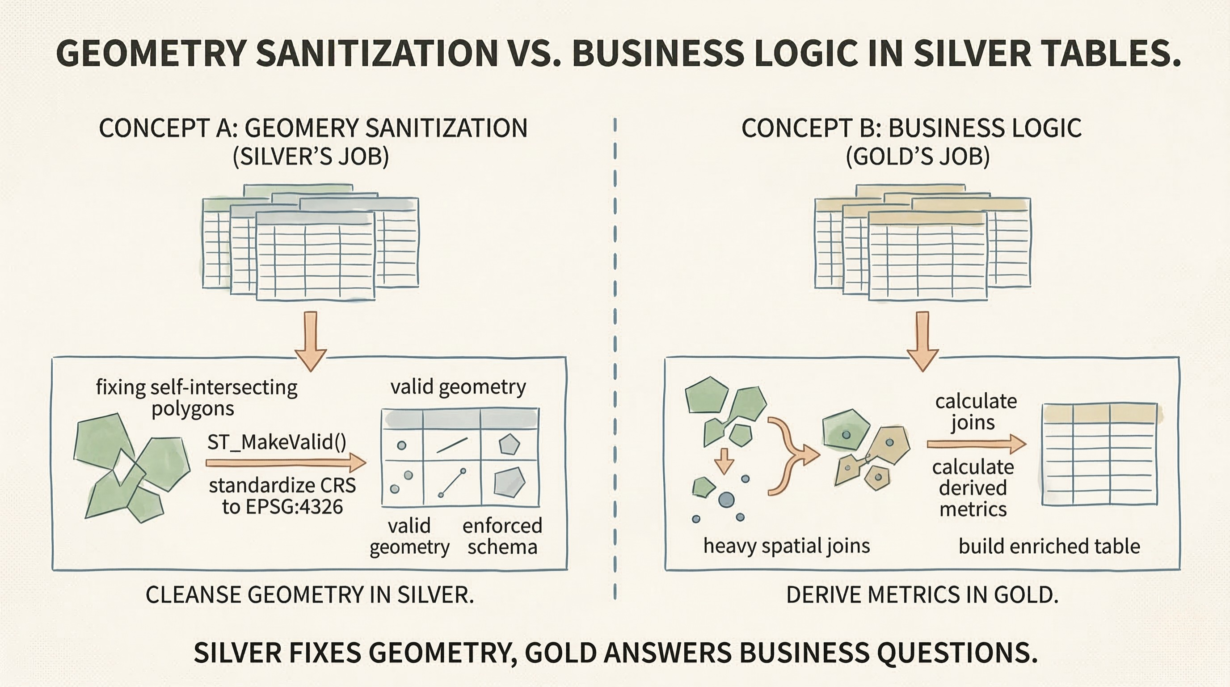
Silver tables exist for one purpose: structural integrity. If you’re calculating business metrics or running spatial aggregations in Silver, you’ve already lost. Downstream teams inherit fragile, unmaintainable dependencies.
The medallion architecture has clear boundaries. Bronze is raw—unvalidated, mixed CRSs, invalid geometries, duplicates. Silver is cleansed—structurally sound, standardized, schema-enforced. Gold is business-ready—metrics, aggregations, domain-specific calculations. Each layer has a job. Blur them and everything breaks.
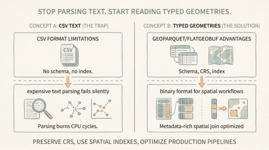
Silver’s job is validation, not computation. Standardize all geometries to EPSG:4326 or your organization’s standard CRS. Don’t reproject on-the-fly during queries—that burns compute and creates inconsistency. Fix self-intersecting polygons with ST_MakeValid() or quarantine them in a separate invalid_geometries table for investigation. Deduplicate features. Enforce schema strictly: all geometry columns must be the same type (not mixed POINT and POLYGON).
Never run heavy spatial joins in Silver. Never calculate derived metrics here. Never execute a complex intersection to build an enriched table. That’s Gold work. Silver is the foundation. Make it bulletproof.
Idempotence matters. If your Silver pipeline reruns, it should produce identical results—no duplicate geometries, no floating-point precision drift. Idempotent pipelines are rerunnable without side effects.
A corrupt geometry leaking past Silver becomes a ticking time bomb. Downstream queries crash. Distributed joins fail silently. Compute budgets explode.
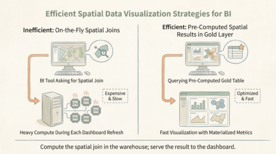
The rule: Silver tables fix the geometry; Gold tables answer the business question. Standardize CRS in Silver, or pay the compute penalty on every downstream query. A self-intersecting polygon in Silver is a budget disaster waiting to happen.
Whenever you’re ready, here are 4 ways I can help you grow in GIS & spatial data:
Spatial Lab – My private community where GIS professionals, data engineers, and analysts connect, swap workflows, and build repeatable systems together.
Modern GIS Accelerator – A guided program to help you break out of legacy GIS habits and learn modern, scalable workflows.
Career Compass – A career-focused program designed to help GIS pros navigate the job market, sharpen their pitch, and find roles beyond traditional GIS paths.
Sponsorship: Interested in sponsoring this newsletter (or other content)? Learn more here and fill out the form to get in touch!