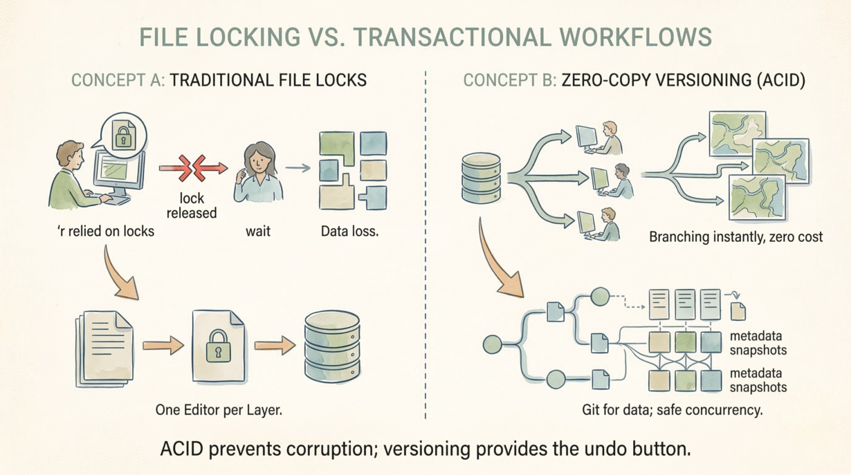
Two analysts editing the same spatial dataset. One locks the file. The other waits. Network hiccup releases the lock without saving changes. Data loss. This is why file-based GIS workflows fail at scale.
ACID transactions prevent partial, fragmented updates. Atomicity means a spatial write either completes fully or rolls back entirely—no corruption. Consistency means the dataset is always valid. Isolation means concurrent writers don’t overwrite each other. Durability means once committed, the data survives failures. Without ACID, file locks become the only defense against chaos.
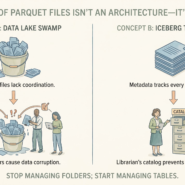
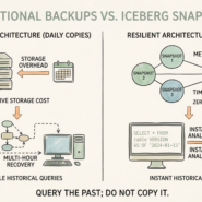
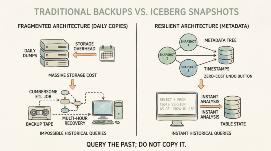
Zero-copy versioning is the operational game-changer. Instead of copying a 100GB dataset to create a “test branch,” versioning systems (like Iceberg) snapshot metadata while sharing physical data. You branch instantly, at zero storage cost. Edit the branch, test scenarios, abandon or merge back. Git for data. No lock files. No “final_v2_real_final_ACTUAL.shp” naming disasters.
The cost savings are brutal. A 1TB production dataset with 10 branches costs 1TB total storage, not 11TB. Branching scales to unlimited parallel experiments.
Scenario testing becomes safe. Model the zoning reclassification on a branch. Run impact analysis. Merge only if approved. The main dataset never experiences the experimental query load.
Traditional GIS relies on locks and manual coordination. One editor per layer. Slow. Fragile. Cloud-native spatial systems use transactions and branching. Unlimited concurrent editors. Safe by design.
The rule: Treat your spatial data like code: branch to experiment, merge to deploy. ACID prevents corruption; versioning provides the undo button. Zero-copy branching scales scenario testing without storage overhead.