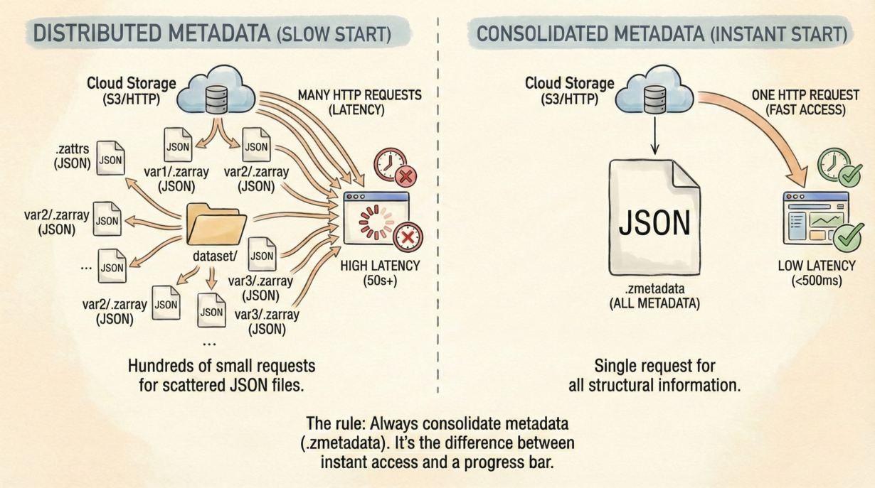
Zarr’s exploded structure is brilliant for I/O throughput but creates a latency trap: opening a dataset with 500 variables requires 500+ HTTP requests to fetch metadata. That’s the difference between instant access and a spinning progress bar.
Here’s the bottleneck: a standard Zarr dataset stores metadata as individual JSON files scattered across the object store. Opening the dataset means traversing the directory tree and requesting each one: group/.zattrs, group/var1/.zarray, group/var2/.zarray… On S3 with 100ms latency per request, 500 requests = 50 seconds. Unacceptable.
Consolidated Metadata solves this. The .zmetadata file aggregates all structural information into a single JSON object. The reader makes one GET request and knows the entire dataset schema, variable shapes, chunk layout, and attributes. 50 seconds becomes 200 milliseconds.
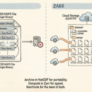
Kerchunk virtualizes this further. It generates Zarr-compliant metadata pointing to byte ranges inside NetCDF or HDF5 files, without copying data. You get instant Zarr-like access to legacy formats. Metadata lives separately from the physical data—pure performance.
The fix is straightforward: zarr.convenience.consolidate_metadata(store) after writing. Always. This single operation determines whether your dataset opens instantly or stalls.
If xr.open_zarr() takes more than 500ms, your metadata isn’t consolidated. Fix it immediately.
The rule: Never leave a Zarr dataset without a .zmetadata file. It’s the difference between instant access and a progress bar. Consolidate metadata as the final step of any data pipeline.
Whenever you’re ready, here are 4 ways I can help you grow in GIS & spatial data:
Spatial Lab – My private community where GIS professionals, data engineers, and analysts connect, swap workflows, and build repeatable systems together.
Modern GIS Accelerator – A guided program to help you break out of legacy GIS habits and learn modern, scalable workflows.
Career Compass – A career-focused program designed to help GIS pros navigate the job market, sharpen their pitch, and find roles beyond traditional GIS paths.
Sponsorship: Interested in sponsoring this newsletter (or other content)? Learn more here and fill out the form to get in touch!