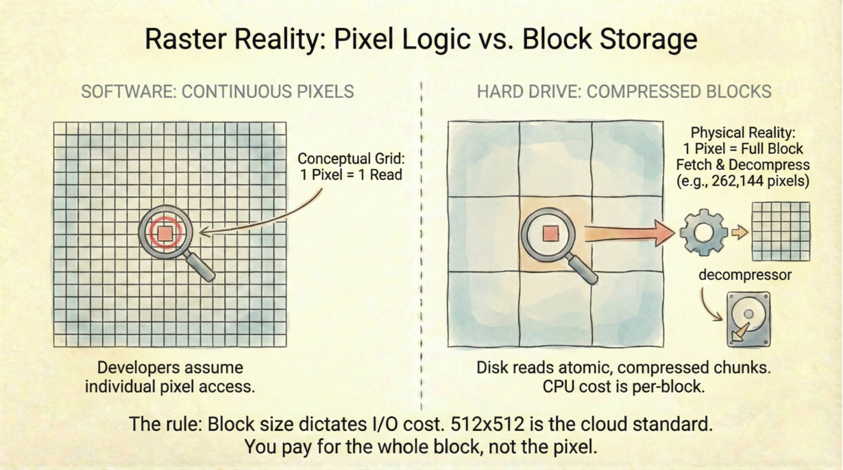
Most developers treat rasters as continuous grids of pixels. They’re not. They’re discrete chunks of compressed data. This distinction determines I/O cost and latency.
A block is the atomic unit of raster storage—a 512×512 or 256×256 square of pixels stored together and compressed as one unit. You cannot read a single pixel without fetching and decompressing the entire block containing it. That’s the constraint.
Compression algorithms (Deflate, ZSTD, LZW) work on blocks. Once you request a pixel, the decompressor inflates the whole block. The CPU cost is fixed per block, regardless of how many pixels you actually use. Read one pixel from a 512×512 block? Decompress all 262,144 pixels. That’s the trade-off.
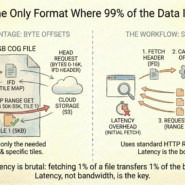
Block sizing determines the latency-bandwidth curve. Small blocks (256×256) mean more HTTP requests to fill a screen—high latency, low per-request bandwidth. Large blocks (1024×1024) mean fewer requests—low latency, but you fetch wasted data if you only need a corner. 512×512 is the cloud standard: the compromise that runs the internet.
Edge artifacts: if your raster dimensions aren’t perfect multiples of block size, the final blocks contain padding (empty data). A 1025×1025 image needs a second row and column of blocks, mostly empty.
Local SSD processing can use 1024. Slow networks demand 256. The internet runs on 512.
The rule: Tune block size for the network, not the disk. Default to BLOCKSIZE=512. Compression is per-block; you pay the whole cost regardless of need.
Whenever you’re ready, here are 4 ways I can help you grow in GIS & spatial data:
Spatial Lab – My private community where GIS professionals, data engineers, and analysts connect, swap workflows, and build repeatable systems together.
Modern GIS Accelerator – A guided program to help you break out of legacy GIS habits and learn modern, scalable workflows.
Career Compass – A career-focused program designed to help GIS pros navigate the job market, sharpen their pitch, and find roles beyond traditional GIS paths.
Sponsorship: Interested in sponsoring this newsletter (or other content)? Learn more here and fill out the form to get in touch!