Draw a straight line between New York and Tokyo on a map. Pilots don’t fly that route. They fly the great circle—which curves on your map but is actually the shortest path on Earth.
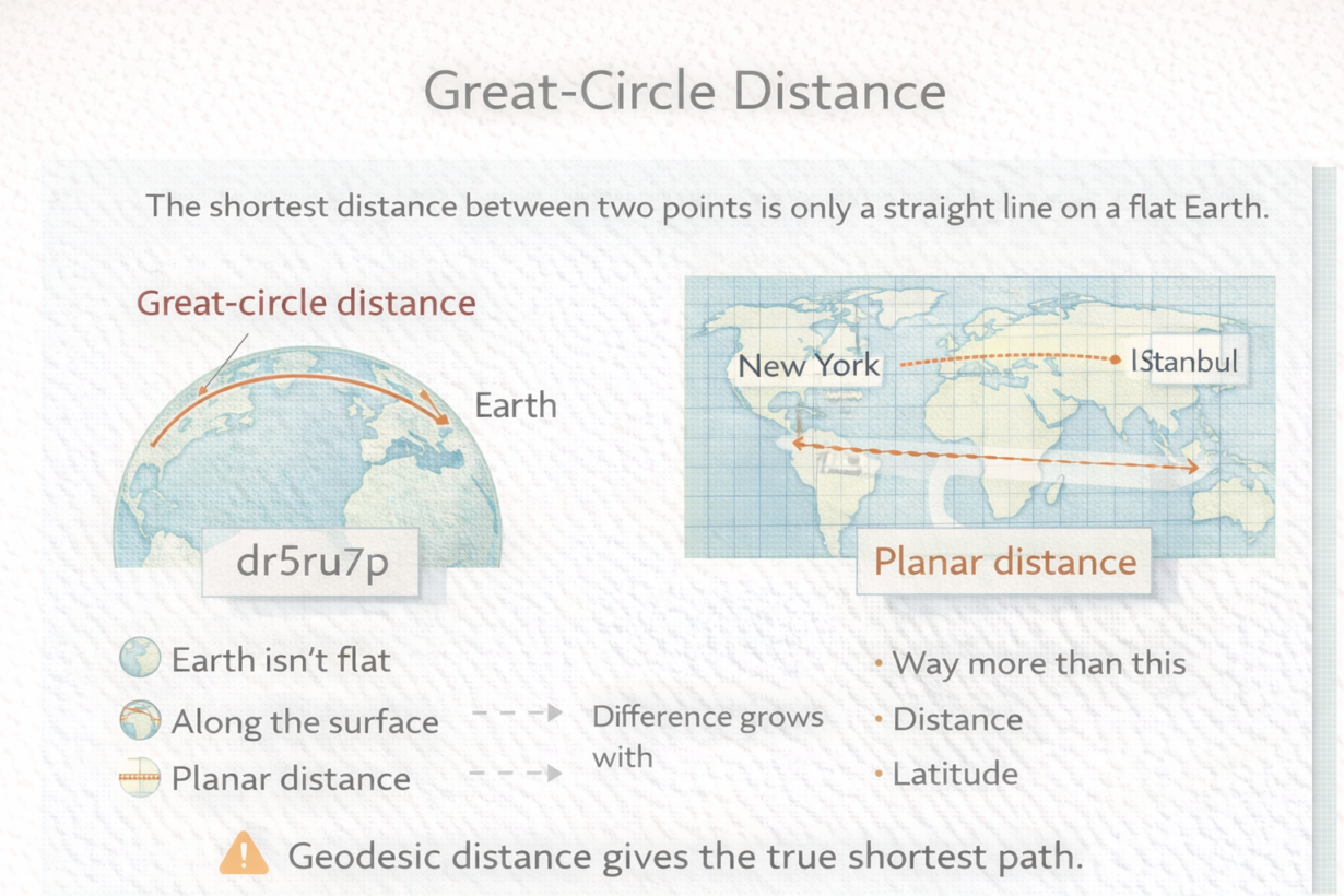
The Earth is a sphere (approximately). A straight line on a flat map isn’t straight on a sphere. Planar distance assumes flat geometry—you measure a straight line using coordinates. Great-circle distance follows the actual curved surface—the arc of the sphere connecting two points.
For short distances, the difference is negligible. Measure 10km in a projected CRS and in geodesic space—nearly identical. Measure 1,000km and the difference grows. Measure across continents or oceans and planar distance can be 5-10% wrong. That’s significant for routing, risk zones, and resource allocation.
Latitude amplifies the error. Distance at the equator is more accurate in planar terms. Distance near the poles is wildly distorted by projections. This is why airline routes curve—they’re following great circles, not straight lines on Mercator maps.
Most GIS tools default to geodesic calculations if you use a geographic CRS (lat/lon). If you use a projected CRS, they calculate planar distance. This usually works out—projected CRS are designed for accurate local measurement. But measuring across multiple projection zones or large areas silently switches you to the wrong math.
The rule: For distances under 100km in a single projection zone, planar is fine. For longer distances or global analysis, use geodesic. Check what your tool is actually calculating. If your CRS is geographic (degrees), distance calculations should be geodesic by default. If not, something is wrong.
Whenever you’re ready, here are 4 ways I can help you grow in GIS & spatial data:
Spatial Lab – My private community where GIS professionals, data engineers, and analysts connect, swap workflows, and build repeatable systems together.
Modern GIS Accelerator – A guided program to help you break out of legacy GIS habits and learn modern, scalable workflows.
Career Compass – A career-focused program designed to help GIS pros navigate the job market, sharpen their pitch, and find roles beyond traditional GIS paths.
Sponsorship: Interested in sponsoring this newsletter (or other content)? Learn more here and fill out the form to get in touch!