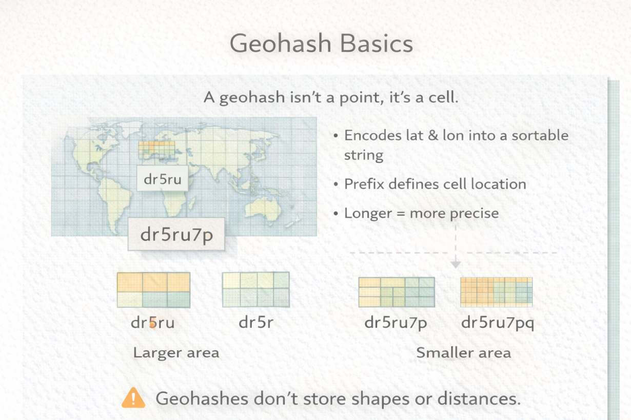
A geohash looks like a location but it’s actually a cell. Treating it as a point is how you end up with edge errors and false negatives in spatial searches.
A geohash encodes latitude and longitude into a sortable string. “ezs42” represents a region around San Francisco. Add another character: “ezs42e” narrows to a smaller region. The pattern continues: longer geohashes equal smaller cells. Each added character divides the previous cell into 32 subcells (base-32 encoding).
Why this matters: a geohash is a hierarchical spatial bucket, not a precise point. “ezs” covers ~1,200km². “ezs42” covers ~20km². “ezs42e6” covers ~600 meters. The precision trades off accuracy for simplicity.
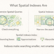
Geohashes are sortable. You can query “all data with geohash prefix ezs42” and you get everything in that region without explicit geometry checks. This makes them valuable for distributed systems, approximate spatial filtering, and bucketing data for parallel processing.
The limitation: geohashes fail at edges. Two nearby points might have completely different geohashes if they straddle a cell boundary. You can’t trust a geohash to determine exact containment. They narrow searches, not decide spatial relationships.
Use geohashes to group data by region, to filter candidates before exact geometry checks, or to distribute work across machines. Don’t use them for precise measurement or final spatial decisions.
The rule: Geohashes trade precision for speed and sortability. Use them as a first filter. Always verify with actual geometry. Longer geohashes are more precise but less compressible. Match length to your problem.
Whenever you’re ready, here are 4 ways I can help you grow in GIS & spatial data:
Spatial Lab – My private community where GIS professionals, data engineers, and analysts connect, swap workflows, and build repeatable systems together.
Modern GIS Accelerator – A guided program to help you break out of legacy GIS habits and learn modern, scalable workflows.
Career Compass – A career-focused program designed to help GIS pros navigate the job market, sharpen their pitch, and find roles beyond traditional GIS paths.
Sponsorship: Interested in sponsoring this newsletter (or other content)? Learn more here and fill out the form to get in touch!