Most organizations default to geodatabases as universal GIS storage. They’re solving the wrong problem—adding complexity and slowing down modern workflows that don’t need it.
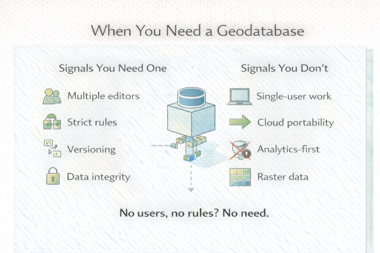
A geodatabase is about control, not storage. It enforces schemas, manages multi-user editing, handles versioning, and prevents data corruption through transactions and locks. If multiple people edit the same features simultaneously and you need to prevent conflicts, a geodatabase works. If you have strict governance requirements and need audit trails, it works. For these cases, the overhead is justified.
A geodatabase is terrible for exploratory analysis, rapid iteration, and cloud-native pipelines. Locks and schema management become friction. You can’t easily export, version with Git, or parallelize processing. Exporting to Parquet, running analysis, and storing results is faster and simpler.
Many teams maintain a geodatabase as a system of record (controlled, governed, multi-user) while using cloud-native formats for analytics layers (flexible, fast, scalable). That hybrid approach is practical.
The mistake: treating geodatabases as required infrastructure. They’re not. Use them when you’re managing coordinated access to shared authoritative data. Skip them for analytics pipelines, data lakes, or single-analyst workflows.
The rule: Multiple people editing the same features at once? Use a geodatabase. Running bulk analysis or feeding a data lake? Use files or cloud storage. Need governance on a system of record? Geodatabase. Need to iterate quickly? Skip it. Don’t default to complexity.
Whenever you’re ready, here are 4 ways I can help you grow in GIS & spatial data:
Spatial Lab – My private community where GIS professionals, data engineers, and analysts connect, swap workflows, and build repeatable systems together.
Modern GIS Accelerator – A guided program to help you break out of legacy GIS habits and learn modern, scalable workflows.
Career Compass – A career-focused program designed to help GIS pros navigate the job market, sharpen their pitch, and find roles beyond traditional GIS paths.
Sponsorship: Interested in sponsoring this newsletter (or other content)? Learn more here and fill out the form to get in touch!