A GIS analyst loading a shapefile, cleaning bad geometries, joining attributes, and producing a dataset is doing data engineering. They just called it “analysis” instead.
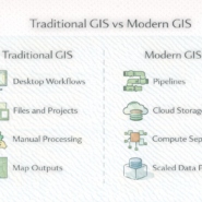
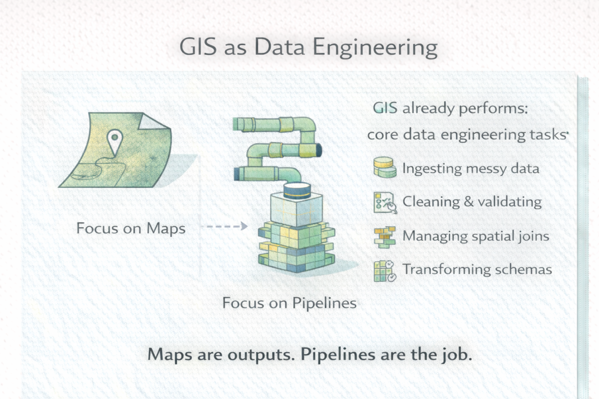
Traditional GIS framed the work as map-making and analysis. But look at what actually happens: raw data arrives (messy, inconsistent, wrong CRS). The analyst ingests it, validates it, transforms it, and produces a clean output that downstream work depends on. That’s a data pipeline. It just looked like desktop work because it ran on a single machine.
Modern GIS makes this explicit. Instead of “load a layer, fix it, export a shapefile,” the work is now “ingest data into a cloud lake, validate with dbt, materialize into Parquet, register in a catalog.” Same underlying task. Different framing.
This reframing changes everything. Traditional GIS optimized for individual analyst productivity—fast iteration, visual feedback. Modern GIS optimizes for system reliability, repeatability, and scale. Version control, testing, monitoring, and documentation matter now because the output isn’t a map—it’s a data product that other systems depend on.
GIS practitioners already know: data cleaning, spatial schema design, indexing, joins, handling coordinate systems. These are core data engineering skills. Layering on SQL, version control, orchestration, and analytics engineering patterns is just extending what they already do.
The rule: Maps are outputs. Pipelines are the job. If you run analysis once, that’s a one-off. If it runs daily, reproducibly, feeding other systems—that’s engineering. Modern GIS is data engineering with spatial data. Start thinking like a systems builder, not a cartographer.
Whenever you’re ready, here are 4 ways I can help you grow in GIS & spatial data:
Spatial Lab – My private community where GIS professionals, data engineers, and analysts connect, swap workflows, and build repeatable systems together.
Modern GIS Accelerator – A guided program to help you break out of legacy GIS habits and learn modern, scalable workflows.
Career Compass – A career-focused program designed to help GIS pros navigate the job market, sharpen their pitch, and find roles beyond traditional GIS paths.
Sponsorship: Interested in sponsoring this newsletter (or other content)? Learn more here and fill out the form to get in touch!