When you drag a map smoothly across your browser, you’re not seeing clever animation. You’re requesting tiles on demand. That’s it. Understanding this changes how you build and deploy maps.
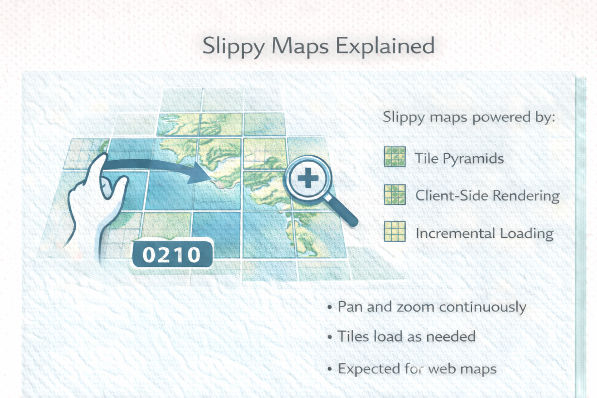
A slippy map is a pan-and-zoom interface. Drag left, and new tiles load on the right. Zoom in, and higher-resolution tiles replace lower ones. Zoom out, and detailed tiles are replaced by overviews. The interaction feels continuous and responsive. Users expect it everywhere now.
Slippy maps work because of three things: a tile pyramid (precomputed at multiple zoom levels), client-side rendering (the browser stitches tiles into a canvas), and incremental loading (tiles arrive as needed, not all at once). Without tiles, you’d have to load the entire map or redraw on every interaction. That would be slow and wasteful.
The system is stateless. The browser asks the server “give me tiles for zoom 8, spanning these coordinates.” The server returns tiles. The browser arranges them and displays them. No session needed. Highly cacheable. Scales to millions of users.
Slippy maps changed how people expect to interact with maps. Desktop GIS tools served a single rendered view. Web maps serve interactive tiles. The difference is fundamental—not just UI, but architecture.
The rule: Slippy maps are the standard for web and mobile maps. Build them with tile infrastructure from the start. The interaction pattern is simple, but the backend must be solid—tile generation, caching, CDN distribution all matter. Tiles are the foundation. Everything else is client-side rendering on top.
Whenever you’re ready, here are 4 ways I can help you grow in GIS & spatial data:
Spatial Lab – My private community where GIS professionals, data engineers, and analysts connect, swap workflows, and build repeatable systems together.
Modern GIS Accelerator – A guided program to help you break out of legacy GIS habits and learn modern, scalable workflows.
Career Compass – A career-focused program designed to help GIS pros navigate the job market, sharpen their pitch, and find roles beyond traditional GIS paths.
Sponsorship: Interested in sponsoring this newsletter (or other content)? Learn more here and fill out the form to get in touch!