A map can look perfectly fine and still be topologically broken. That’s when analysis breaks.
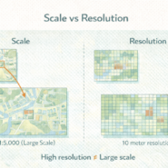
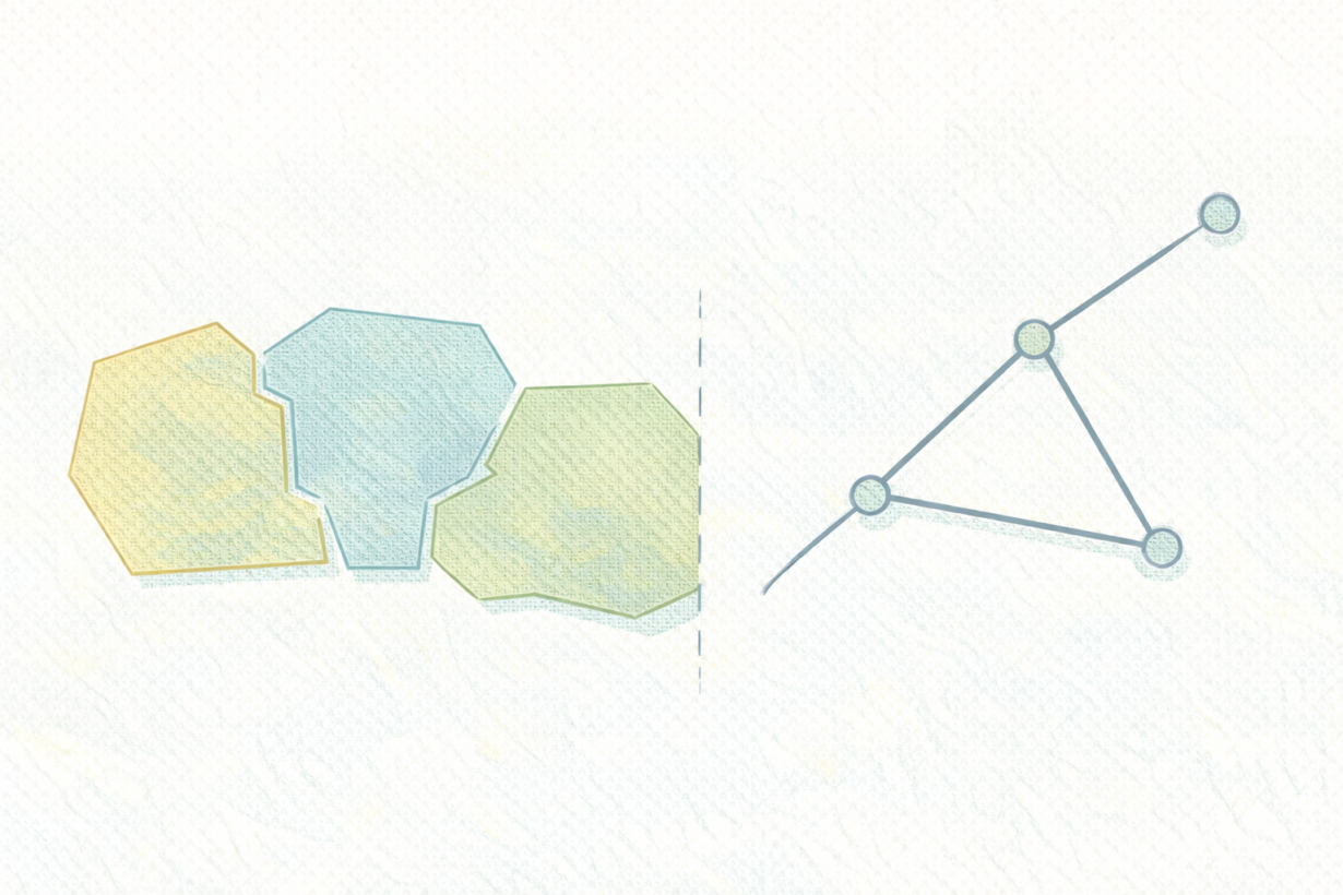
Topology describes spatial relationships, not geometry. It’s about what’s connected, what’s adjacent, what contains what. A topological rule for a zoning layer might be: “Polygons must not overlap” and “Polygons must not have gaps.” These aren’t about perfect curves or precise coordinates. They’re about integrity.
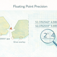
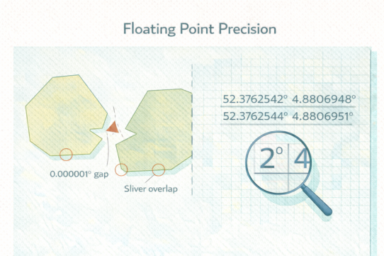
Why this matters: visually correct data can violate topology. Two zone polygons might look separate on screen but share a tiny sliver of overlapping boundary due to digitization error. The map looks fine. But a spatial join produces duplicates. Area calculations are wrong. Routing fails across the boundary. The topological error broke downstream analysis.
Common topology errors include slivers (tiny overlaps), gaps (missing coverage), and dangling lines (endpoints that don’t connect). None are obvious to the eye. All cause silent failures.
Topology is critical for networks (roads must connect), boundaries (zoning must have no gaps), and any analysis relying on relationships. It’s optional for disconnected feature collections (tree locations, building centroids). But for anything representing a system—infrastructure, administrative boundaries, cadastral data—topology is non-negotiable.
The rule: Before analyzing shared boundaries or networks, validate topology. Most tools have built-in validation (PostGIS ST_IsValid, GeoPandas validity checks). If topology errors exist, fix them first. Don’t assume clean-looking data is clean. A sliver or gap that’s invisible on screen can invalidate weeks of analysis downstream. Validate early.
Whenever you’re ready, here are 4 ways I can help you grow in GIS & spatial data:
Spatial Lab – My private community where GIS professionals, data engineers, and analysts connect, swap workflows, and build repeatable systems together.
Modern GIS Accelerator – A guided program to help you break out of legacy GIS habits and learn modern, scalable workflows.
Career Compass – A career-focused program designed to help GIS pros navigate the job market, sharpen their pitch, and find roles beyond traditional GIS paths.
Sponsorship: Interested in sponsoring this newsletter (or other content)? Learn more here and fill out the form to get in touch!