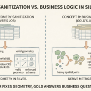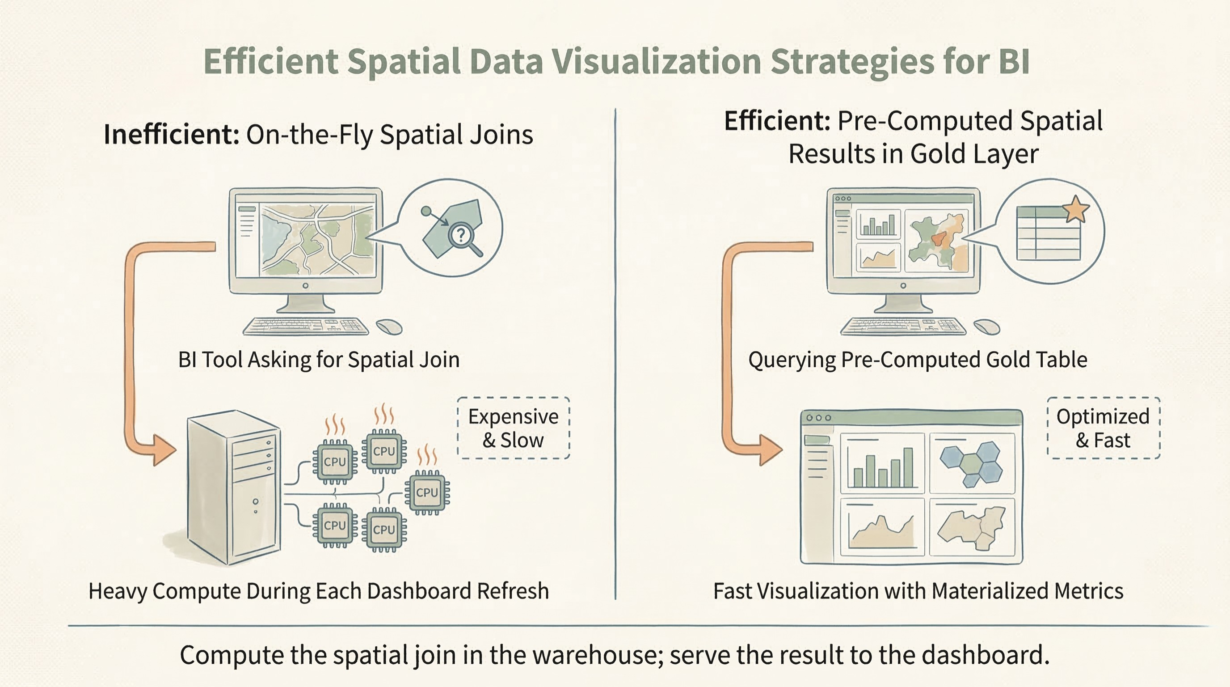
Silver is clean. Gold is fast. If your dashboard is running point-in-polygon queries on the fly, your Gold layer isn’t doing its job. Every refresh waits for distributed compute. Your infrastructure bill explodes.
Gold tables exist to absorb computational burden so dashboards don’t have to. All heavy spatial operations (intersects, distances, unions, containment) happen during pipeline execution—once, offline, at night. The result is a pre-computed metric ready to visualize instantly.
Pre-compute heavily. A dashboard asking “what’s the average property value by zoning district?” should query a materialized table with results already calculated, not execute a million-geometry spatial join at request time. Join once. Serve the answer a thousand times.
Aggregate spatial data ruthlessly. Millions of individual point features kill web performance. Aggregate into H3 hexagons or Geohash cells. A heatmap of 100,000 points becomes 500 pre-aggregated hexagons. Rendering becomes instant. Payload shrinks 200x.
Simplify geometries. A detailed parcel boundary with 50,000 vertices serves one purpose: legal accuracy. A dashboard rendering all parcels in a region doesn’t need that detail. ST_Simplify() reduces vertices to 500 with imperceptible visual loss. Payload drops 100x. Rendering time falls proportionally.
Denormalize aggressively. A Gold table should include owner name, assessed value, zoning, geometry, and any other attribute a dashboard might need—no joins required.
The rule: Compute the spatial join in the warehouse; serve the result to the dashboard. Pre-aggregate points into H3 grids; it cuts BI costs orders of magnitude. Silver is for engineers; Gold is for the renderer.
Whenever you’re ready, here are 4 ways I can help you grow in GIS & spatial data:
Spatial Lab – My private community where GIS professionals, data engineers, and analysts connect, swap workflows, and build repeatable systems together.
Modern GIS Accelerator – A guided program to help you break out of legacy GIS habits and learn modern, scalable workflows.
Career Compass – A career-focused program designed to help GIS pros navigate the job market, sharpen their pitch, and find roles beyond traditional GIS paths.
Sponsorship: Interested in sponsoring this newsletter (or other content)? Learn more here and fill out the form to get in touch!