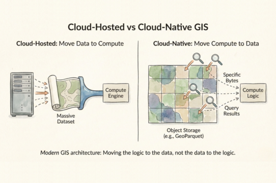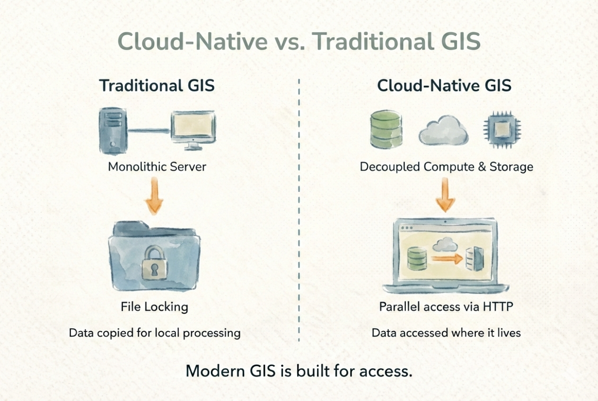
Moving ArcGIS to an AWS server isn’t cloud-native GIS. It’s just a slower version of desktop GIS. Cloud-native means rethinking how spatial data is stored and accessed—a different architecture, not just a different location.
Cloud-native GIS is object-storage first. Data sits in S3, Azure Blob, or similar, not in databases or file servers. Compute and storage are decoupled. Multiple processes read the same data without locking. A 50GB raster doesn’t load fully into memory—HTTP range requests pull only the bytes needed.
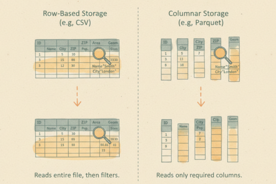
This changes everything. Traditional GIS copies data to your machine to work with it. Cloud-native GIS reads data where it lives. Formats like GeoParquet and Cloud-Optimized GeoTIFF are designed for this: column-oriented storage, internal tiling, overviews. A query touching 1% of a dataset reads 1%, not 100%.
Why it matters: scale without proportional cost. Hundreds of analysts reading the same dataset don’t replicate it. Parallel processing is natural—no locks, no coordination overhead. Collaboration works. Automation scales.
Traditional GIS struggles here. File locking prevents concurrent access. Monolithic servers can’t handle thousands of simultaneous queries. Stateful workflows resist automation.
Cloud-native GIS is a design philosophy, not a vendor choice. PostGIS, DuckDB with spatial extensions, Apache Sedona, all support cloud-native patterns when configured properly.
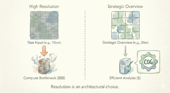
The rule: If your data lives in object storage, your GIS should read it there. If you’re moving terabytes, cloud-native pays for itself. If you’re doing one-off desktop analysis, traditional GIS is fine. Modern GIS is built for reading less, not moving more.
Whenever you’re ready, here are 4 ways I can help you grow in GIS & spatial data:
Spatial Lab – My private community where GIS professionals, data engineers, and analysts connect, swap workflows, and build repeatable systems together.
Modern GIS Accelerator – A guided program to help you break out of legacy GIS habits and learn modern, scalable workflows.
Career Compass – A career-focused program designed to help GIS pros navigate the job market, sharpen their pitch, and find roles beyond traditional GIS paths.
Sponsorship: Interested in sponsoring this newsletter (or other content)? Learn more here and fill out the form to get in touch!