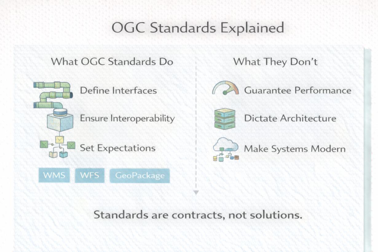
Many organizations insist on OGC compliance assuming it guarantees interoperability or modern architecture. It doesn’t. Standards define contracts, not solutions.
The Open Geospatial Consortium (OGC) writes specifications that let systems talk to each other without depending on vendors. WMS (Web Map Service) defines how to request rendered maps. WFS (Web Feature Service) defines how to request vector features. Simple Features defines geometry encoding. GeoPackage defines a portable file format. These are contracts: if you implement this spec, I know how to use your system.
OGC standards solve a real problem—you can mix a WMS from vendor A with a client from vendor B because both follow the spec. Without standards, systems are locked in. That matters.
But OGC standards don’t guarantee performance, scalability, or modern architecture. A standards-compliant system can still be slow, rigid, or outdated. And modern systems often outrun the specs. Cloud-native spatial pipelines, vector tiles, and serverless compute aren’t well-served by older OGC standards because those systems weren’t imagined when the specs were written.
The practical approach: use OGC standards at system boundaries where interoperability matters. Insist on WMS/WFS compliance when integrating external systems. Require GeoPackage portability when long-term data access is critical. But don’t mandate standards inside your pipeline just because they exist. Move data fast internally. Standards are negotiation points between systems.
The rule: Standards are insurance for future system changes, not guarantees of quality or modernity. Use them where you need to connect different vendors. Evaluate if you need them where you control the entire stack.
Whenever you’re ready, here are 4 ways I can help you grow in GIS & spatial data:
Spatial Lab – My private community where GIS professionals, data engineers, and analysts connect, swap workflows, and build repeatable systems together.
Modern GIS Accelerator – A guided program to help you break out of legacy GIS habits and learn modern, scalable workflows.
Career Compass – A career-focused program designed to help GIS pros navigate the job market, sharpen their pitch, and find roles beyond traditional GIS paths.
Sponsorship: Interested in sponsoring this newsletter (or other content)? Learn more here and fill out the form to get in touch!