Moving traditional workflows to the cloud doesn’t make them modern. Modern GIS is a different organizational model, not just newer tools.
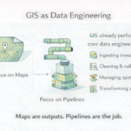
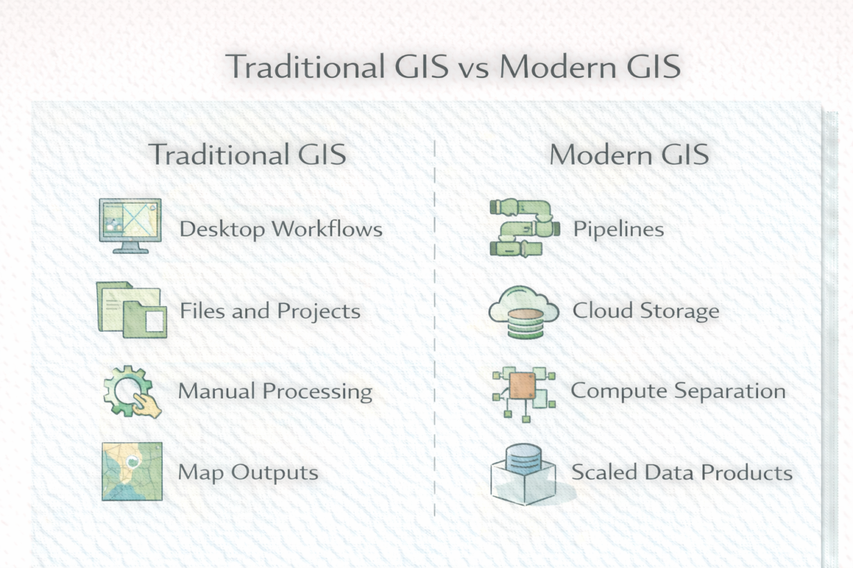
Traditional GIS is tool-centric. A GIS analyst opens ArcGIS or QGIS, loads a project, performs analysis manually or with scripts, produces a map or report. The tool is the center. Data lives in files or a database. Workflows are documentable but not easily repeatable. Scaling means hiring more analysts.
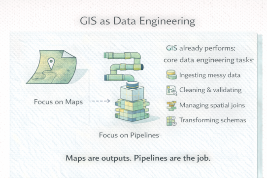
Modern GIS is system-centric. Spatial analysis is one step in a data pipeline. Raw data flows in, transformations run (SQL, Python, spatial operations), results are stored as queryable datasets or APIs. Code is versioned. Processes are automated. Scaling means better infrastructure, not more people. The outcome is a data product, not a map.
The structural difference matters. Traditional GIS optimizes for individual productivity—”how fast can one analyst complete this analysis?” Modern GIS optimizes for repeatability and scale—”how do we run this 1,000 times on new data?”
This changes skills. Spatial knowledge still matters. But now you need SQL, version control, distributed systems thinking, and data modeling. You stop thinking “what layers do I need?” and start thinking “how does data flow through the system?”
Many organizations run hybrid workflows—traditional analysis feeding modern pipelines. That’s fine. But the shift isn’t about tools. It’s about moving spatial logic from the center of the process to one component in a larger system.
The rule: Traditional GIS produces maps. Modern GIS produces systems. Both need spatial expertise. But careers are built differently. Learn pipeline thinking, not just layer management.
Whenever you’re ready, here are 4 ways I can help you grow in GIS & spatial data:
Spatial Lab – My private community where GIS professionals, data engineers, and analysts connect, swap workflows, and build repeatable systems together.
Modern GIS Accelerator – A guided program to help you break out of legacy GIS habits and learn modern, scalable workflows.
Career Compass – A career-focused program designed to help GIS pros navigate the job market, sharpen their pitch, and find roles beyond traditional GIS paths.
Sponsorship: Interested in sponsoring this newsletter (or other content)? Learn more here and fill out the form to get in touch!