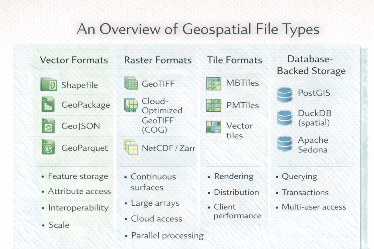
People ask “what format should I use?” as if one answer exists. It doesn’t. Formats specialize. Understanding why prevents wasted time converting data or using the wrong tool for the job.
Vector formats store discrete features (points, lines, polygons). Shapefile was the standard for decades but is fragile at scale (file size limits, no transactions). GeoPackage is SQLite-backed—single file, transactions, works offline. GeoJSON is human-readable and web-native but bloated. GeoParquet is the modern choice: columnar storage, cloud-native, queryable without loading everything.
Raster formats store continuous surfaces. GeoTIFF is standard but file-based. Cloud-Optimized GeoTIFF (COG) adds internal tiling and overviews for cloud streaming. NetCDF and Zarr enable parallel processing and time-series data—critical for climate, weather, and large arrays.
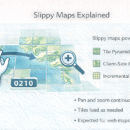
Tile formats (MBTiles, PMTiles, vector tiles) are prerendered subsets optimized for display. They’re not for analysis—they’re for fast client-side rendering. Every slippy map uses them.
Databases (PostGIS, DuckDB, Snowflake) are for querying and multi-user access. Data lives in tables, indexable and transactional. Not for bulk export but for interactive analysis and production systems.
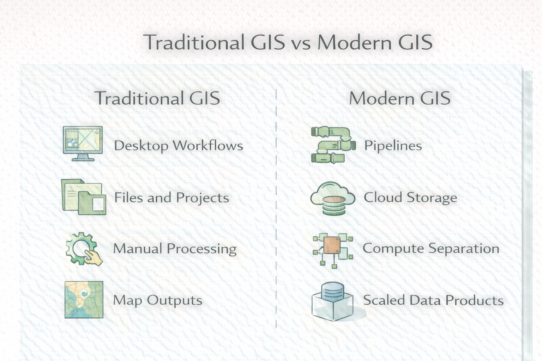
The mistake: forcing one format everywhere. Shapefile for everything. Or storing tiles in a database. Each format solves a specific problem.
The rule: Choose by access pattern. Bulk analysis? Parquet. Interactive queries? Database. Web rendering? Tiles. Need portability? GeoPackage. Expect to convert data between formats—that’s normal. Format choice is about performance and scalability, not tradition.
Whenever you’re ready, here are 4 ways I can help you grow in GIS & spatial data:
Spatial Lab – My private community where GIS professionals, data engineers, and analysts connect, swap workflows, and build repeatable systems together.
Modern GIS Accelerator – A guided program to help you break out of legacy GIS habits and learn modern, scalable workflows.
Career Compass – A career-focused program designed to help GIS pros navigate the job market, sharpen their pitch, and find roles beyond traditional GIS paths.
Sponsorship: Interested in sponsoring this newsletter (or other content)? Learn more here and fill out the form to get in touch!