

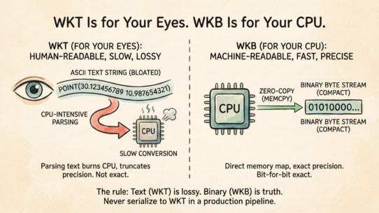
#57: WKT Is for Your Eyes. WKB Is for Your CPU
Both formats represent identical geometry. They’re optimized for opposite purposes. Confusing them in…
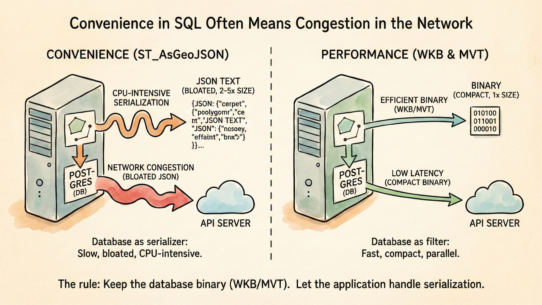
#56: Convenience in SQL Often Means Congestion in the Network
ST_AsGeoJSON looks efficient in queries. It’s a disaster in production APIs. You’re forcing a…
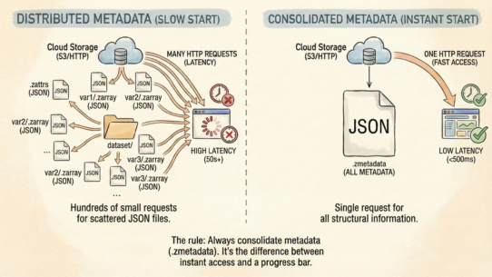
#55: Distributed Data Is Fast. Distributed Metadata Is Slow.
Zarr’s exploded structure is brilliant for I/O throughput but creates a latency trap: opening a dataset…
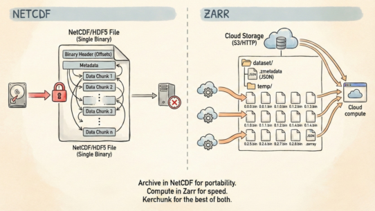
#54: NetCDF Assumes You Have a File System. Zarr Assumes You Have a URL
NetCDF and Zarr handle identical data. They’re optimized for different infrastructure. Moving between them…
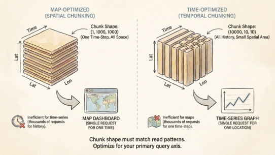
#53: There Is No Correct Chunk Shape, Only the Shape That Matches Your Query
A climate model and a weather dashboard want the same data. They access it completely differently. Default…
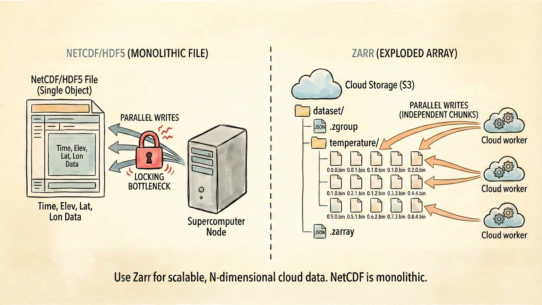
#52: NetCDF Was Built for Supercomputers. Zarr Is Built for the Cloud.
NetCDF/HDF5 treat data as a single file with complex internal pointers. Updating one time-step often requires…
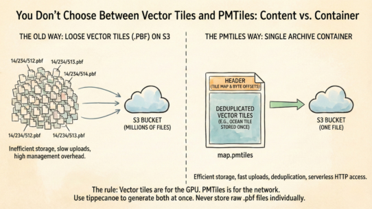
#51: You Don’t Choose Between Vector Tiles and PMTiles
Vector Tiles and PMTiles are not competitors. They’re content and container. Confusing them is how teams…
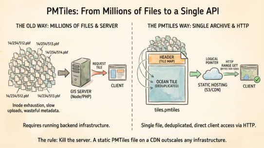
50: PMTiles Turns a Directory of a Million Files Into a Single API
Most teams hosting vector tiles still run a server. They don’t need to. PMTiles is a single-file archive…
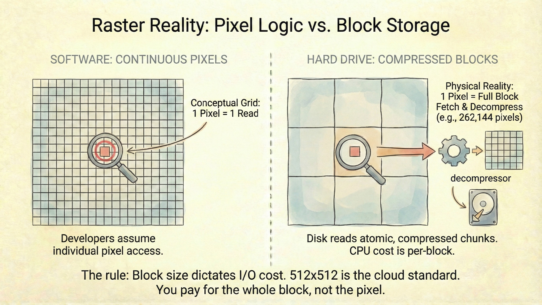
#49: Your Software Thinks in Pixels, But Your Hard Drive Thinks in Blocks
Most developers treat rasters as continuous grids of pixels. They’re not. They’re discrete chunks of…
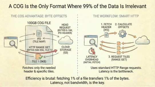
48: A COG Is the Only Format Where 99% of the Data Is Irrelevant
The “magic” of streaming a 100GB raster from a browser is actually simple: byte offsets. A COG tells…


