


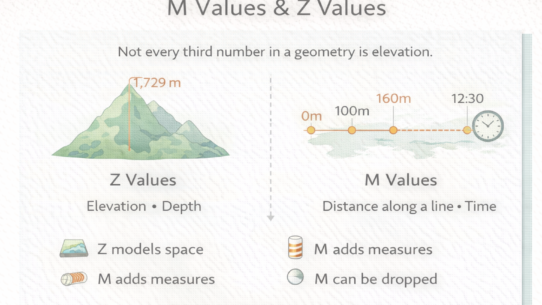
#31: Z and M Are Different Dimensions
Most GIS tools silently drop M values because people confuse them with Z. They’re not interchangeable.…
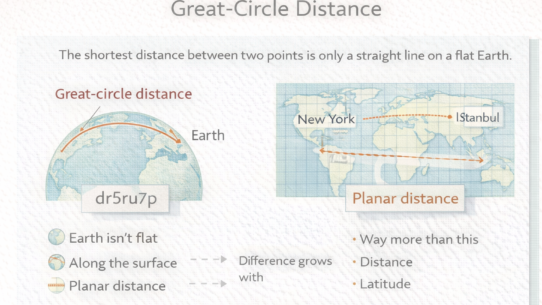
#30: The Shortest Distance Between Two Points Is Not a Straight Line
Draw a straight line between New York and Tokyo on a map. Pilots don’t fly that route. They fly the great…
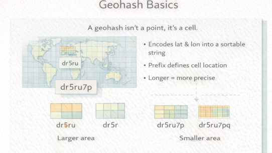
#29: Geohashes Are Cells, Not Points
A geohash looks like a location but it’s actually a cell. Treating it as a point is how you end up with…

#28: Spatial Indexes Are Search Structures, Not Data
Most spatial queries are slow because they’re checking every geometry. A spatial index fixes this by…
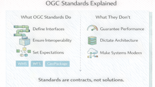
#27: OGC Standards Don’t Make Systems Modern
Many organizations insist on OGC compliance assuming it guarantees interoperability or modern architecture. It…
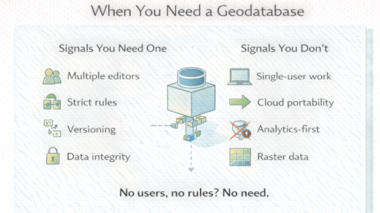
#26: Not Every GIS Dataset Belongs in a Geodatabase
Most organizations default to geodatabases as universal GIS storage. They’re solving the wrong…
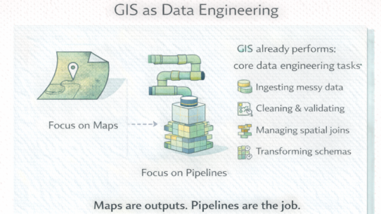
#25: GIS Didn’t Become Data Engineering. It Always Was.
A GIS analyst loading a shapefile, cleaning bad geometries, joining attributes, and producing a dataset is doing…
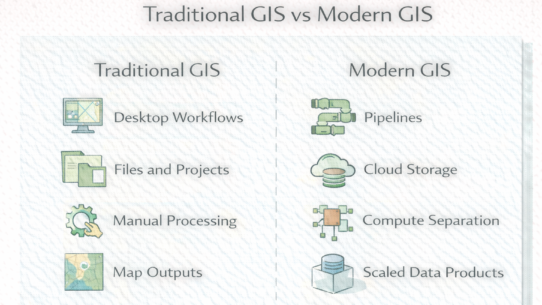
#24: Modern GIS Isn’t Traditional GIS in the Cloud
Moving traditional workflows to the cloud doesn’t make them modern. Modern GIS is a different…
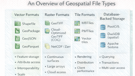
#23: Why There’s No Single Geospatial File Format
People ask “what format should I use?” as if one answer exists. It doesn’t. Formats…
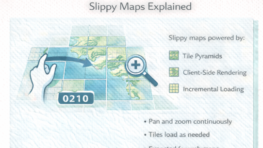
#22: Slippy Maps Aren’t Magic, They’re Just Tiles
When you drag a map smoothly across your browser, you’re not seeing clever animation. You’re…


