Serving a single high-resolution image to a million users would bankrupt you. Tile pyramids are why panning and zooming feel instant instead of painful.
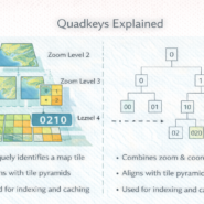
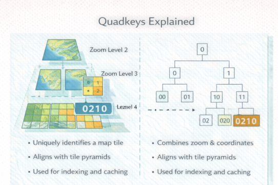
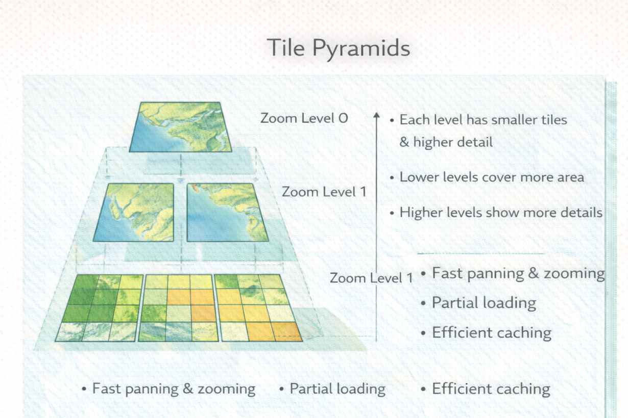
A tile pyramid is a map broken into small images (tiles) at multiple zoom levels. Zoom level 0 is the entire world in a few tiles. Zoom level 10 shows a city in thousands of tiles. Zoom level 20 shows a street in millions. Each level is precomputed and stored.
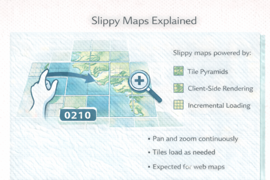
When you zoom in on a map, the client requests only the tiles visible in your viewport. Zoom level 3 needs maybe 20 tiles. Zoom level 15 might need 100. You only download what’s on screen. Pan left, and the server sends new tiles. Zoom out, and it swaps to lower-resolution tiles. All precomputed.
Why this matters: sending a single 4GB image of the world would require downloading all 4GB before showing anything. Tiles let users see data instantly and progressively load detail. They enable caching at multiple levels—browser cache, CDN cache, server cache. Each zoom shift hits pre-rendered data, not computation.
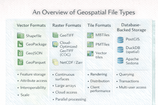
Tile pyramids power every major map service: Google Maps, Mapbox, OpenStreetMap. They work for raster imagery and vector tiles equally well.
The structure is standardized (zoom/x/y coordinates), so tiles from different sources can stack together. Basemap from one provider, overlay from another—they align because both follow the pyramid structure.
The rule: If your map needs interactive zoom, use a tile pyramid. If you’re serving a single static image, skip it. Tiles are about responsiveness and scale. Building them takes time upfront but pays back infinitely. Never serve raw rasters to web clients expecting zoom—generate tiles instead.
Whenever you’re ready, here are 4 ways I can help you grow in GIS & spatial data:
Spatial Lab – My private community where GIS professionals, data engineers, and analysts connect, swap workflows, and build repeatable systems together.
Modern GIS Accelerator – A guided program to help you break out of legacy GIS habits and learn modern, scalable workflows.
Career Compass – A career-focused program designed to help GIS pros navigate the job market, sharpen their pitch, and find roles beyond traditional GIS paths.
Sponsorship: Interested in sponsoring this newsletter (or other content)? Learn more here and fill out the form to get in touch!