Most people measure distance in their projected CRS and assume the answer is correct. It often isn’t, especially over larger areas.
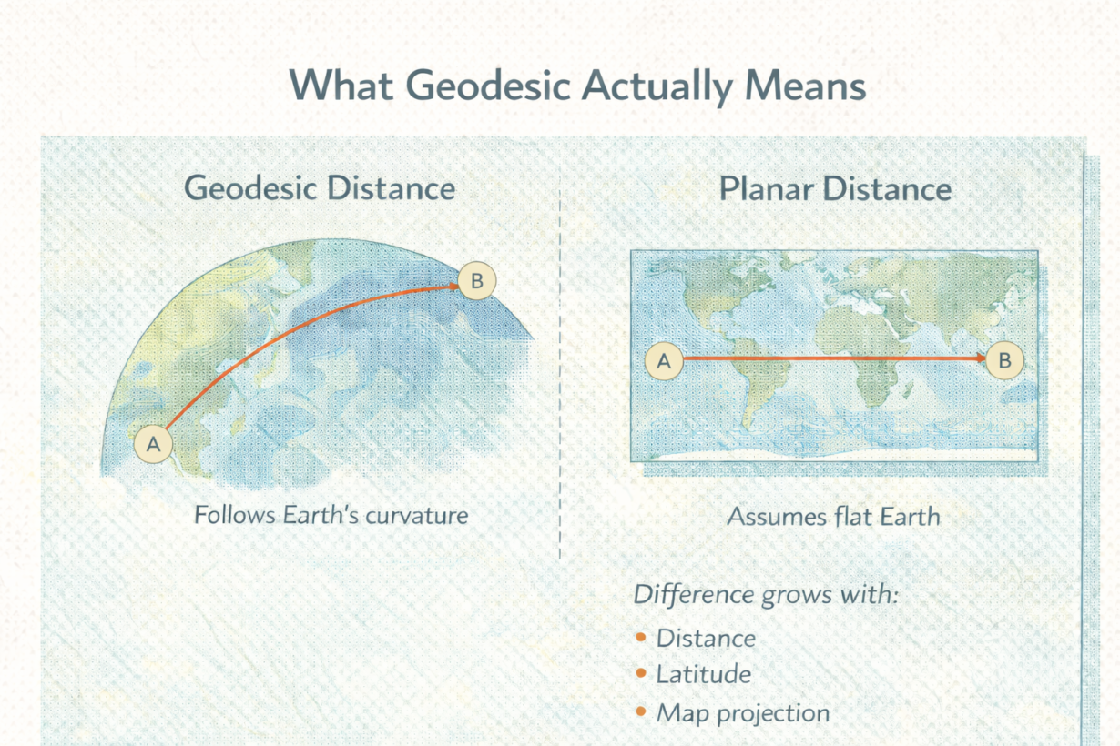
Planar distance treats the Earth as flat. Measure a straight line between two points using coordinates. Simple. Fast. Works for small areas. Geodesic distance follows the actual curved surface of the Earth. A true shortest path between two points isn’t a straight line on a map—it’s an arc. Over regional or global scales, the difference is significant.
Here’s the magnitude. Measure 100km in a projected CRS—you get 100km. Measure geodesic distance across the same two points, and you might get 102km or 98km depending on latitude and direction. Measure 1,000km, and the difference grows. At continental scale, planar distance can be off by 5-10%. That breaks density analysis, routing, and site selection.
Buffers behave differently too. A planar buffer in a projected CRS creates a circle that looks wrong at the edges. A geodesic buffer respects Earth’s curvature. For any analysis spanning a region or more, geodesic is more accurate.
The mistake: assuming a good projection eliminates curvature. It doesn’t. Projections minimize distortion in a specific area, but they still flatten. For measurement across large distances, geodesic is required.
The rule: For analysis within a single UTM zone or small region, planar distance is acceptable. For regional analysis, use geodesic. For global datasets, always use geodesic. Modern tools (PostGIS, GeoPandas, DuckDB) support geodesic calculations natively. Enable them. The accuracy cost is negligible. Ignoring curvature is how you get wrong answers at scale.
Whenever you’re ready, here are 4 ways I can help you grow in GIS & spatial data:
Spatial Lab – My private community where GIS professionals, data engineers, and analysts connect, swap workflows, and build repeatable systems together.
Modern GIS Accelerator – A guided program to help you break out of legacy GIS habits and learn modern, scalable workflows.
Career Compass – A career-focused program designed to help GIS pros navigate the job market, sharpen their pitch, and find roles beyond traditional GIS paths.
Sponsorship: Interested in sponsoring this newsletter (or other content)? Learn more here and fill out the form to get in touch!